














Environments, Vol. 10, Pages 212: The Use of Satellite Synthetic Aperture Radar Imagery to Assist in the Monitoring of the Time Evolution of Challenging Coastal Environments: A Case Study of the Basilicata Coast
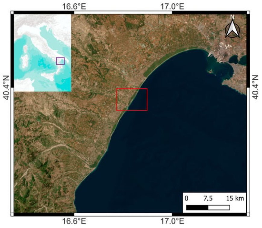
This study focuses on a very complex environment, namely the Ionian coast of the Basilicata region, Southern Italy, which includes different kinds of beaches, river mouths and built-up areas. This complex environment is used as a test case to analyze the time variability of the coastline using measurements that were remotely sensed by the satellite European Copernicus Synthetic Aperture Radar (SAR) mission. First, the accuracy of the coastline, extracted by the SAR, is discussed with respect to finer-spatial-resolution drone-based light detection and ranging (LIDAR) measurements. Then, a time series of SAR dual-polarimetric measurements acquired by the European Copernicus mission is used to discuss the time variability of the coastline of the area of interest in a time period spanning from 2015 to 2021. The experimental results show that the accuracy of the SAR-based coastline is better than 15 m, which is reasonably good precision for monitoring the erosion/accretion processes that characterize the area of interest at a moderate scale. The estimated time variability of the extracted coastline suggests a dominant erosion process, which is always within 60 m.
Environments, Vol. 10, Pages 212: The Use of Satellite Synthetic Aperture Radar Imagery to Assist in the Monitoring of the Time Evolution of Challenging Coastal Environments: A Case Study of the Basilicata Coast
Environments doi: 10.3390/environments10120212
Authors: Emanuele Ferrentino Nicola Angelo Famiglietti Ferdinando Nunziata Giovanna Inserra Andrea Buono Raffaele Moschillo Antonino Memmolo Gerardo Colangelo Annamaria Vicari Maurizio Migliaccio
This study focuses on a very complex environment, namely the Ionian coast of the Basilicata region, Southern Italy, which includes different kinds of beaches, river mouths and built-up areas. This complex environment is used as a test case to analyze the time variability of the coastline using measurements that were remotely sensed by the satellite European Copernicus Synthetic Aperture Radar (SAR) mission. First, the accuracy of the coastline, extracted by the SAR, is discussed with respect to finer-spatial-resolution drone-based light detection and ranging (LIDAR) measurements. Then, a time series of SAR dual-polarimetric measurements acquired by the European Copernicus mission is used to discuss the time variability of the coastline of the area of interest in a time period spanning from 2015 to 2021. The experimental results show that the accuracy of the SAR-based coastline is better than 15 m, which is reasonably good precision for monitoring the erosion/accretion processes that characterize the area of interest at a moderate scale. The estimated time variability of the extracted coastline suggests a dominant erosion process, which is always within 60 m.
What's Your Reaction?