













Environments, Vol. 11, Pages 82: ClimateDT: A Global Scale-Free Dynamic Downscaling Portal for Historic and Future Climate Data
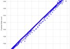
Statistical downscaling of climate data has been widely described in the literature, with the aim of improving the reliability of local climatic parameters from coarse-resolution (often >20 km) global datasets. In this article, we present ClimateDT, a dynamic downscaling web tool for monthly historical and future time series at a global scale. The core of ClimateDT is the 1 km 1981–2010 climatology from CHELSA Climate (version 2.1), where the CRU-TS layers for the period 1901-current are overlayed to generate a historic time series. ClimateDT also provides future scenarios from CMIP5 using UKCP18 projections (rcp2.6 and rcp8.5) and CMIP6 using 5 GCMs, also available on the CHELSA website. The system can downscale the grids using a dynamic approach (scale-free) by computing a local environmental lapse rate for each location as an adjustment for spatial interpolation. Local predictions of temperature and precipitation obtained by ClimateDT were compared with climate time series assembled from 12,000 meteorological stations, and the Mean Absolute Error (MAE) and the explained variance (R2) were used as indicators of performance. The average MAEs for monthly values on the whole temporal scale (1901–2022) were around 1.26 °C for the maximum monthly temperature, 0.80 °C for the average monthly temperature, and 1.32 °C for the minimum monthly temperature. Regarding monthly total precipitation, the average MAE was 19 mm. As for the proportion of variance explained, average R2 values were always greater than 0.95 for temperatures and around 0.70 for precipitation due to the different degrees of temporal autocorrelation of precipitation data across time and space, which makes the estimation more complex. The elevation adjustment resulted in very accurate estimates in mountainous regions and areas with complex topography and substantially improved the local climatic parameter estimations in the downscaling process. Since its first release in November 2022, more than 1300 submissions have been processed. It takes less than 2 min to calculate 45 locations and around 8 min for the full dataset (512 records).
Environments, Vol. 11, Pages 82: ClimateDT: A Global Scale-Free Dynamic Downscaling Portal for Historic and Future Climate Data
Environments doi: 10.3390/environments11040082
Authors: Maurizio Marchi Gabriele Bucci Paolo Iovieno Duncan Ray
Statistical downscaling of climate data has been widely described in the literature, with the aim of improving the reliability of local climatic parameters from coarse-resolution (often >20 km) global datasets. In this article, we present ClimateDT, a dynamic downscaling web tool for monthly historical and future time series at a global scale. The core of ClimateDT is the 1 km 1981–2010 climatology from CHELSA Climate (version 2.1), where the CRU-TS layers for the period 1901-current are overlayed to generate a historic time series. ClimateDT also provides future scenarios from CMIP5 using UKCP18 projections (rcp2.6 and rcp8.5) and CMIP6 using 5 GCMs, also available on the CHELSA website. The system can downscale the grids using a dynamic approach (scale-free) by computing a local environmental lapse rate for each location as an adjustment for spatial interpolation. Local predictions of temperature and precipitation obtained by ClimateDT were compared with climate time series assembled from 12,000 meteorological stations, and the Mean Absolute Error (MAE) and the explained variance (R2) were used as indicators of performance. The average MAEs for monthly values on the whole temporal scale (1901–2022) were around 1.26 °C for the maximum monthly temperature, 0.80 °C for the average monthly temperature, and 1.32 °C for the minimum monthly temperature. Regarding monthly total precipitation, the average MAE was 19 mm. As for the proportion of variance explained, average R2 values were always greater than 0.95 for temperatures and around 0.70 for precipitation due to the different degrees of temporal autocorrelation of precipitation data across time and space, which makes the estimation more complex. The elevation adjustment resulted in very accurate estimates in mountainous regions and areas with complex topography and substantially improved the local climatic parameter estimations in the downscaling process. Since its first release in November 2022, more than 1300 submissions have been processed. It takes less than 2 min to calculate 45 locations and around 8 min for the full dataset (512 records).
What's Your Reaction?