











Hydrology, Vol. 10, Pages 216: Calibration of Land-Use-Dependent Evaporation Parameters in Distributed Hydrological Models Using MODIS Evaporation Time Series Data
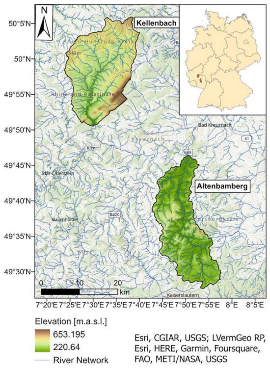
The land-use-specific calibration of evapotranspiration parameters in hydrologic modeling is challenging due to the lack of appropriate reference data. We present a MODIS-based calibration approach of vegetation-related evaporation parameters for two mesoscale catchments in western Germany with the physically based distributed hydrological model WaSiM-ETH. Time series of land-use-specific actual evapotranspiration (ETa) patterns were generated from MOD16A2 evapotranspiration and CORINE land-cover data from homogeneous image pixels for the major land-cover types in the region. Manual calibration was then carried out for 1D single-cell models, each representing a specific land-use type based on aggregated 11-year mean ETa values using SKout and PBIAS as objective functions (SKout > 0.8, |PBIAS| < 5%). The spatio-temporal evaluation on the catchment scale was conducted by comparing the simulated ETa pattern to six daily ETa grids derived from LANDSAT data. The results show a clear overall improvement in the SPAEF (spatial efficiency metric) for most land-use types, with some deficiencies for two scenes in spring and late summer due to phenological variation and a particularly dry hydrological system state, respectively. The presented method demonstrates a significant improvement in the simulation of ETa regarding both time and spatial scale.
Hydrology, Vol. 10, Pages 216: Calibration of Land-Use-Dependent Evaporation Parameters in Distributed Hydrological Models Using MODIS Evaporation Time Series Data
Hydrology doi: 10.3390/hydrology10120216
Authors: Markus C. Casper Zoé Salm Oliver Gronz Christopher Hutengs Hadis Mohajerani Michael Vohland
The land-use-specific calibration of evapotranspiration parameters in hydrologic modeling is challenging due to the lack of appropriate reference data. We present a MODIS-based calibration approach of vegetation-related evaporation parameters for two mesoscale catchments in western Germany with the physically based distributed hydrological model WaSiM-ETH. Time series of land-use-specific actual evapotranspiration (ETa) patterns were generated from MOD16A2 evapotranspiration and CORINE land-cover data from homogeneous image pixels for the major land-cover types in the region. Manual calibration was then carried out for 1D single-cell models, each representing a specific land-use type based on aggregated 11-year mean ETa values using SKout and PBIAS as objective functions (SKout > 0.8, |PBIAS| < 5%). The spatio-temporal evaluation on the catchment scale was conducted by comparing the simulated ETa pattern to six daily ETa grids derived from LANDSAT data. The results show a clear overall improvement in the SPAEF (spatial efficiency metric) for most land-use types, with some deficiencies for two scenes in spring and late summer due to phenological variation and a particularly dry hydrological system state, respectively. The presented method demonstrates a significant improvement in the simulation of ETa regarding both time and spatial scale.
What's Your Reaction?